
View Probability of Occurrence Map in Google Earth and Retrieve Raster Data for ArcGIS
The output file package that is viewable in Google Earth (a KML file and a png file), as well as the output raster (in ASCII format) will be emailed to you within one hour. Follow the steps below to view your map
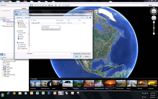
1. Viewing PO map in Google Earth
- Download the kml file and the png file and save them in the same folder on your computer.
- Open Google Earth
- Click on the “File” dropdown menu and select “Open”. A navigation window will open.
- In the navigation window, navigate to your KML file, select it, and then click “Open”.
2. Retrieving Raster Data
To convert the ASCII file into a visual format (in ESRI's ArcGIS), use the ASCII to Raster tool located in the Conversion -> To Raster toolbox. Change the output data type to FLOAT. The raster's coordinate system will be the same as the input - lat/long, North American Datum 1983.
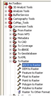
The navigation window in ArcToolbox. Go to Conversion Tools -> To Raster -> ASCII
to Raster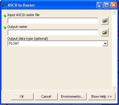
Select your downloaded text file, the desired output raster name (note that the names cannot start with numbers or be longer than 10 characters).
Go on to step 6 of 6