
How to survey for good probability of occurrence (PO) maps
After management goals have been defined for a specific land area and target species are chosen, the next step is to assess favorable conditions for each species. Since most land managers have neither the time nor resources to do a complete inventory of their area, it is necessary to complete a survey that will represent the range of conditions that are found at the site.
This survey must be both varied and efficient, taking into account the limited time or resources that are available for fieldwork. For example, if the area under management includes both riparian areas and mountainous areas, then it would be best to include both of those habitat types in the survey. The same concept should be applied to slope, aspect, distance to roads and elevation (see figures 1 through 3).
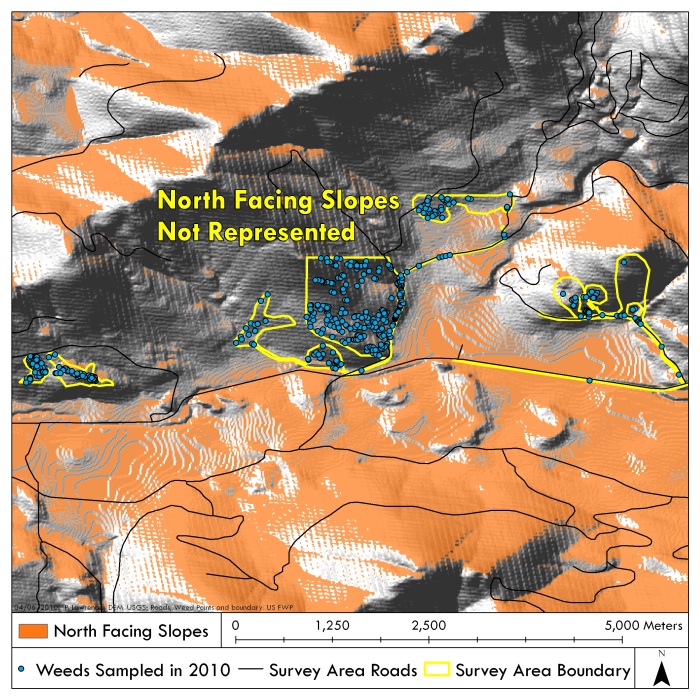
Figure 1: In this map showing areas that have been surveyed, only South-facing aspects have been included. Surveys should attempt to cover a wide range of aspects.
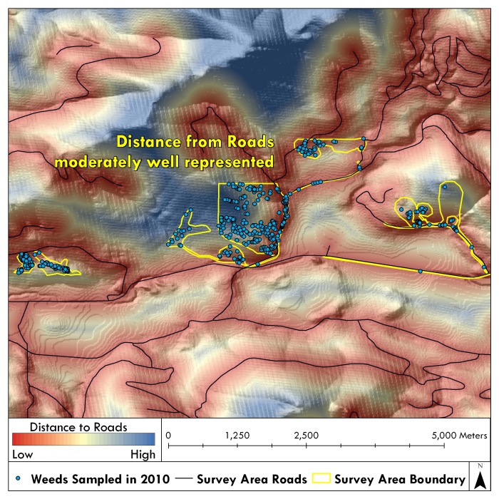
Figure 2: In this map areas with a variety of distances from roads have been surveyed.
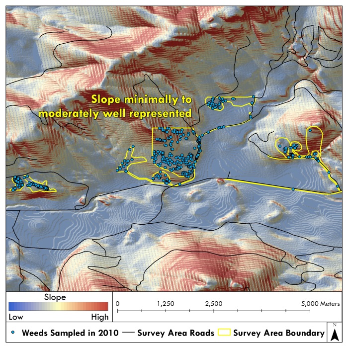
Figure 3: This figure shows that slopes were minimally to moderately well sampled. It would be better to include both very flat areas and very steep areas.
Two main approaches are available that will meet these conditions, and that will fit into the format necessary for generating a PO map. Both require the use Global Positioning System (GPS) units with data collection capabilities and ESRI ArcGIS software. They are as outlined in the links below.