
Collate and Error Check Data
To produce the most accurate results, it is recommended that the data are error-checked for outliers or discrepancies. For example, if the point and polygon sampling method is used, then any points that fall out of the survey area boundary should be eliminated. Furthermore, survey areas should not overlap within any given year (though they may overlap between years if this is the case then combine the separate shapefiles before uploading). If the transect sampling method is used, then each plant start point should be checked to make sure it corresponds to a plant end point for the same species. Points without any species recorded or incomplete information should be either corrected or eliminated.
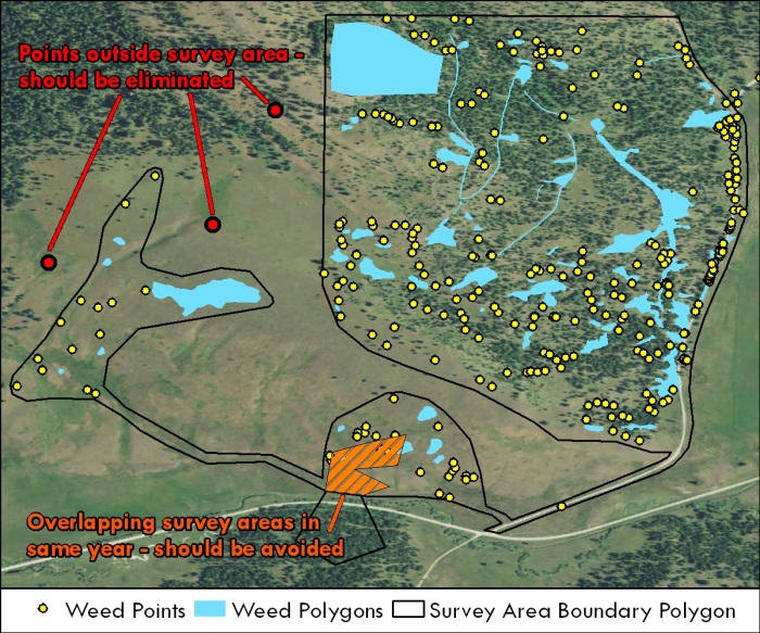
Figure 4. Checking your data for consistency is critical to ensure that the web application performs as expected. Please try to correct the errors shown above.