
Point And Polygon Sampling Procedures
Point and Polygon Sampling
This approach may be easier to implement, but introduces the possibility of biased sampling that will skew the results. It is composed of two tasks - delineating the area that will be completely surveyed, and looking within that area for individual weeds or patches of weeds. These tasks are often done in conjunction with NIS spraying or other management activities. As much as possible, the surveyed areas should cover a wide array of representative ecotypes, slopes, aspects and distances from roads. A variety of GPS units may be used for this task, however we recommend using one that can obtain better than 5 meter accuracy and has data recording capabilities (to associate observations with gps measurements). The following data are recorded with this approach:
- The survey area. This represents the total area that is searched, which is marked by a polygon (or polygons). The shapefile should include fields for "species_1", "species_2", etc. which will contain the latin names of the searched-for species that correspond to each polygon. It should be recorded separately from the weed polygons and points.
- The weed polygons/points Within the survey boundary, weeds may be marked as either points or polygons. The required fields are the same as for the survey area.
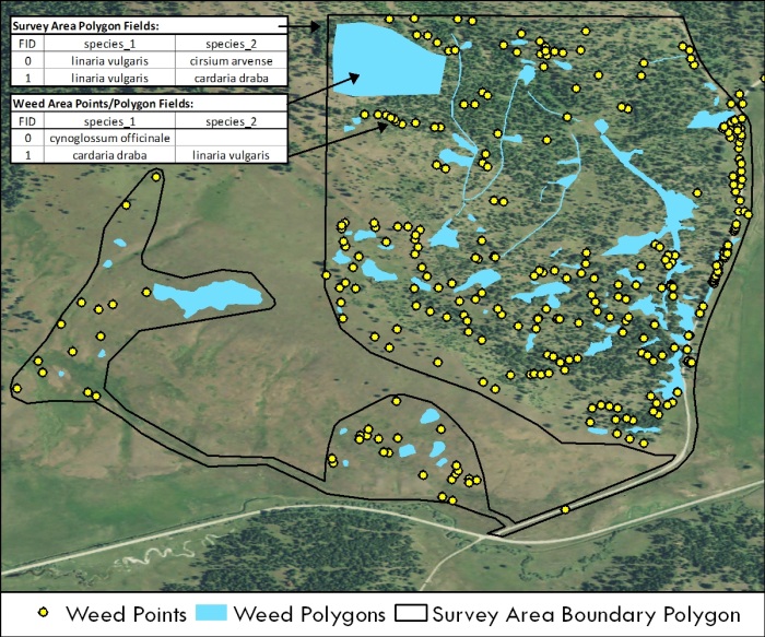
Figure 5. Diagram showing point and polygon data, the survey boundary and a representative attribute table.